


Map of 30A Florida – Complete Scenic Highway 30A Community Map
If you're searching for a 30A map, this is it. The map below highlights the full stretch of 30A from Dune Allen to Inlet Beach, including popular Gulf-front communities like Blue Mountain Beach, Grayton Beach, Seaside, WaterColor, Seagrove, Alys Beach, Seacrest, and Rosemary Beach. It also includes state parks, coastal dune lakes, highway connections, and surrounding areas like Santa Rosa Beach, Point Washington, and Watersound Origins.
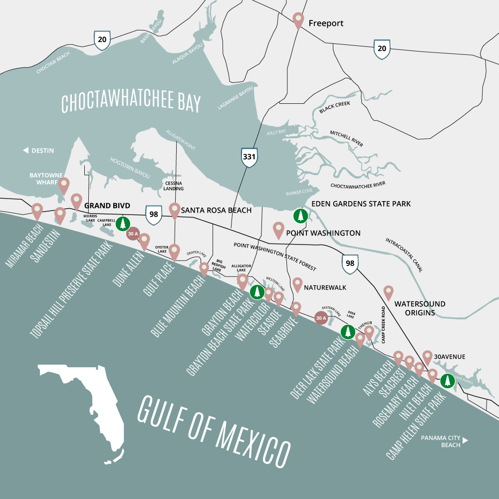
Where is 30A located in Florida?
30A is in South Walton County in the Florida Panhandle, between Destin and Panama City Beach.
What towns are included on the 30A map?
Gulf Place, Blue Mountain Beach, Grayton Beach, WaterColor, Seaside, Seagrove, Watersound, Alys Beach, Seacrest, Rosemary Beach, and Inlet Beach.
Is 30A part of Destin or Panama City Beach?
No—30A is its own coastal corridor located roughly halfway between the two.
How long is 30A?
Scenic Highway 30A is about 24 miles long.